Maps & Data
Safety is our top priority
Vision Zero SF adopts a data-driven approach to safety, following the models of the San Francisco Pedestrian Strategy and the WalkFirst program. By using over half a decade of information collected by police officers, engineers and health officials, San Francisco has the ability to identify trends and patterns within the complexity of our city. The Department of Public Health has created multiple websites that allow all residents, staff and advocates to access the information in usable ways, ensuring transparency and accountability throughout the planning process.
View the most current monthly fatality report.View Here
Key Information
Since 2014, San Francisco has adopted four action strategies, outlining the steps the City will take to get to zero, and new protocols for tracking traffic fatalities and improving the understanding of Vision Zero’s impact:
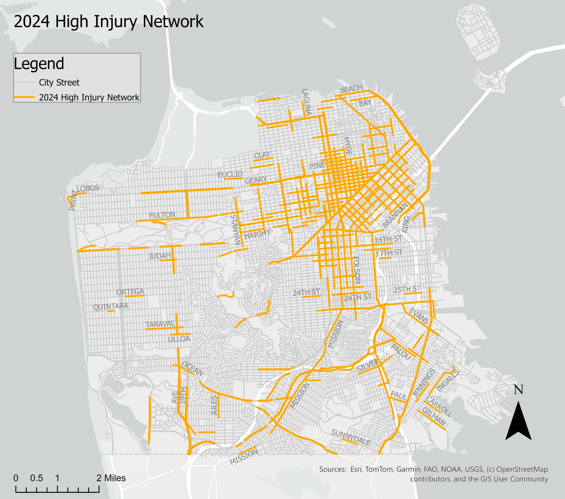
2024 High Injury Network
Based on years of data, these maps identify where the most investments in engineering, education and enforcement should be focused to have the biggest impact in reducing fatalities and severe injuries:
Vision Zero Reports
Vision Zero Maps